Joshua Kocherthal (1669-1719), Lutheran pastor at Landau in Bavaria, was the leader of the emigrants from the Palatinate. In 1704 he went to London to make the necessary arrangements. Two years later he published a booklet on the proposed emigration. In 1708 he sailed for the New World with the first fifty-three souls, landing in New York at the close of December, 1708, or the beginning of January, 1709, after a long and stormy voyage lasting about four months. It was the first German Lutheran congregation in the State of New York. After spending the winter in the city, they settled on the right bank of the Hudson, near the mouth of the Quassaic, where Newburgh is now located. Every person received a grant of fifty acres and the congregation five hundred acres of church land, which, however, the British Governor in 1750 awarded to the Episcopalians. In July, 1709, Kocherthal, entrusting his congregation to the care of Falckner, whose acquaintance he had made during the winter in New York, returned to London to obtain, through a personal interview with the Queen, grants of money which were needed to supply the utterly destitute colonists with the necessary means of subsistence until the land was made arable. He returned in June, 1710, with a multitude of emigrants in eleven ships. But, while 3,000 had sailed from London, only 2,200 were destined to reach their homes in the New World, 800 having died while en route and in quarantine on Governor's Island. A tract of land comprising 40 acres for each person was assigned to them at the foot of the Catskill Mountains, about 100 miles north of New York. They settled on both sides of the Hudson, naming their settlements East and West Camp, respectively. READ MORE...
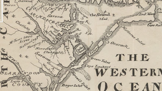
Below is an enlargement of the eastern Carolina portion of the map.


