This undated map, created by Jacob Chace for Gray, was never recorded or published by O.W. Gray & Son. The map has been dated 1877 and 1882 (when Gray's Atlas of North Carolina was published). 1880 is a more accurate date for this Beaufort map.
_________________________________________________________________________
CLUES to dating this map:- In 1870, Charles Lowenberg lived near the corner of Pollock and Front streets. The structure was noted on Gray's map as the "Sea Side House - Chas. Lowenberg." In the 1880 census, Lowenberg was noted as a "hotel keeper."
- Gray noted Atlantic Hotel Lot, Pollock and Front, which means the map was done after the hotel was destroyed in the August 1879 hurricane.
- "O.W. Gray & Son" was not formed until 1875 when Gray's partner Prof. Walling retired.
- Gray's maps of a few North Carolina towns, available online, are all UNDATED and include "O.W. Gray & Son" on the maps. Sources date these maps circa 1882, most likely due to the date published as a set, part of Gray's NC Atlas. (Peter Sandbeck)
- The Beaufort map does not include "O.W. Gray & Son" but does include the Jacob Chace stamp.
- Therefore, it is believed that the Beaufort map was most likely a draft by Jacob Chace, perhaps sold in town but never registered or published.
- Neither Gray nor Chace included a date on the face of their maps.
_______________________
"Gray's Atlas Map of North Carolina"
1873 "Gray's Atlas of the United States with General Maps of the World"
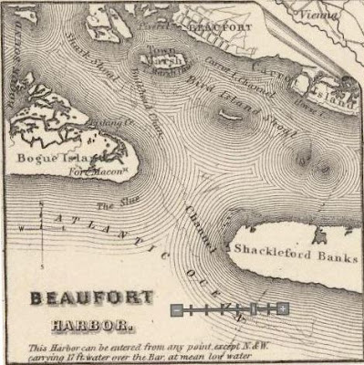
included an inset map of Beaufort Harbor


